 |
|
|
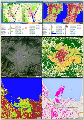
Objective The main objective of this research project is to provide geospatial solutions related to urbanization processes in world populated cities through Web-based geovisualization techniques. In this project, we intend to use Landsat MSS/TM/ETM/OLI-TIRS, ALOS AVNIRS, ASTER Global Digital Elevation Model and other ancillary GIS data sets to examine the land cover changes in world populated cities through WebGIS by providing geovisualization techniques such as thematic mapping, quantitative analysis, visual change analysis, spatial change analysis, etc.
Principle Investigator Professor Dr. Yuji Murayama
Project Leader Dr. Ko Ko Lwin
Data Credit Dr. Ronald C. Estoque, Shyamantha Subasinghe, Hou Hao and Hao Gong
Contact Us |
|
|
© 2014, Division of Spatial Information Science, University of Tsukuba |
|